
Location: In Prescott Park of Medford, Oregon
Length: 4 miles of trail. (Most of it is a loop.)

Foot Traffic
The trails along Roxy Ann Peak are open to hikers, bikers, and horseback riders. Some local avid runners can be found running loops around the peak in any weather. It’s also a good workout for cyclists, considering the climb in terrain. But the majority of people are hikers like I was. While I could occasionally get a moment alone, on the main trail I could expect a fellow hiker to walk around the bend at any given moment.
I’ve only ever walked Roxy Ann alone. Okay, that’s not entirely true, since I have faded memories of my family going there when I was very young. But in the couple of times I’ve walked this in my adulthood, I’ve always felt safe going solo.

Foot Feelings
Roxy Ann has a special meaning to me this year. It was my first walk of 2017. I was a bit pressed for time on New Year’s Day, so I didn’t have time to make it to the summit. Seven weeks later, I finally made it to the top.
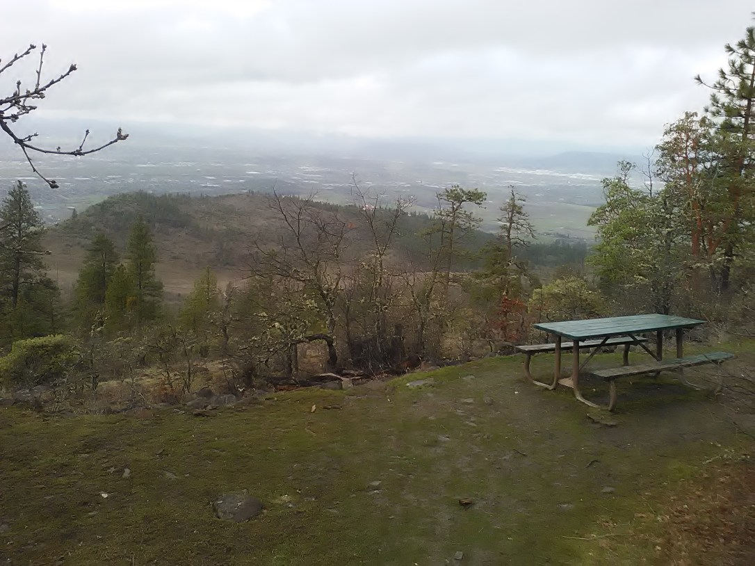
Besides being a good workout, Roxy Ann Peak is ideal for its stunning views overlooking the Southern Oregon city. As the crowning feature of Medford’s largest city park, Roxy Ann gives you a birds-eye view of what some travelers may just see as a town for vineyards, rivers, and access to Crater Lake National Park.
I especially like that Roxy Ann is walkable year-round. It was snowing fairly heavily on January 1st, and yet I was not the only one who thought it was a perfect day to go for a hike. While the rain can wash out some of the side trails, the main path is well-maintained since it doubles as a service road for employees who need to work on the mountaintop antenna.
Roxy Ann Peak definitely got my blood pumping, but it did so in such a fun way it didn’t feel too much like a workout. I think many people can enjoy this walk, including families and individuals, active and non-athletic alike. If nothing else, go for the views.
Trail Tips
-Drive up the gravel road as far as you’re allowed. You’ll find a closed yellow gate and probably several parked cars where you’ll have to stop, as only pedestrians are allowed beyond that point. But driving to the gate is a nice head start.
-There are several side trails you can take, but since they are always more muddy and eroded than the main trail, I have not walked any of these.
-You’ll eventually walk to a fork in the road. You can choose to go either way, as this is the beginning of the loop around the mountain.
-Keep a lookout for the trail to the summit. It’s not clearly marked. After a steep hike, you’ll get to the antennas that top the peak.
-Don’t worry if you don’t have the energy to hike to the summit. You can actually get better views of the city below along the main trail anyway.
-Make sure to bring water! You can also carry a meal as there are a few areas for picnicking.
Pin this:


1 thought on “Roxy Ann Peak”