day trip, geography, hike, saving money, souvenir, travel tips

Two Days, Two States, Two National Park Sites!

It has been quite the weekend! In addition to Earth Day on Friday  and celebrating the entire weekend with Earth Day-themed posts, I was out celebrating nature as well! Just between yesterday and today, I took two trips, both to National Park Service sites. And one of them even called for hopping the border between Oregon and California!

Saturday: Lava Beds National MonumentDSCF5020

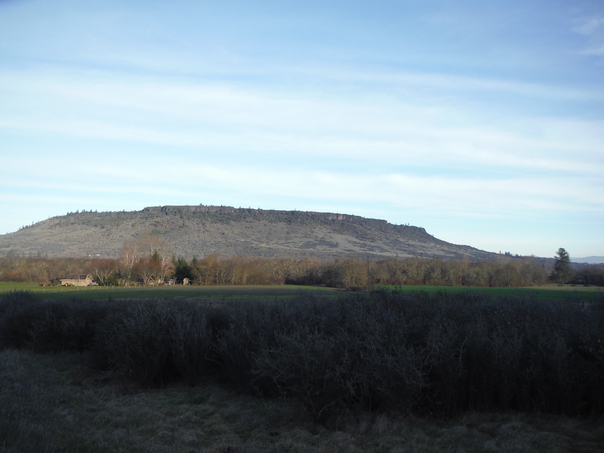
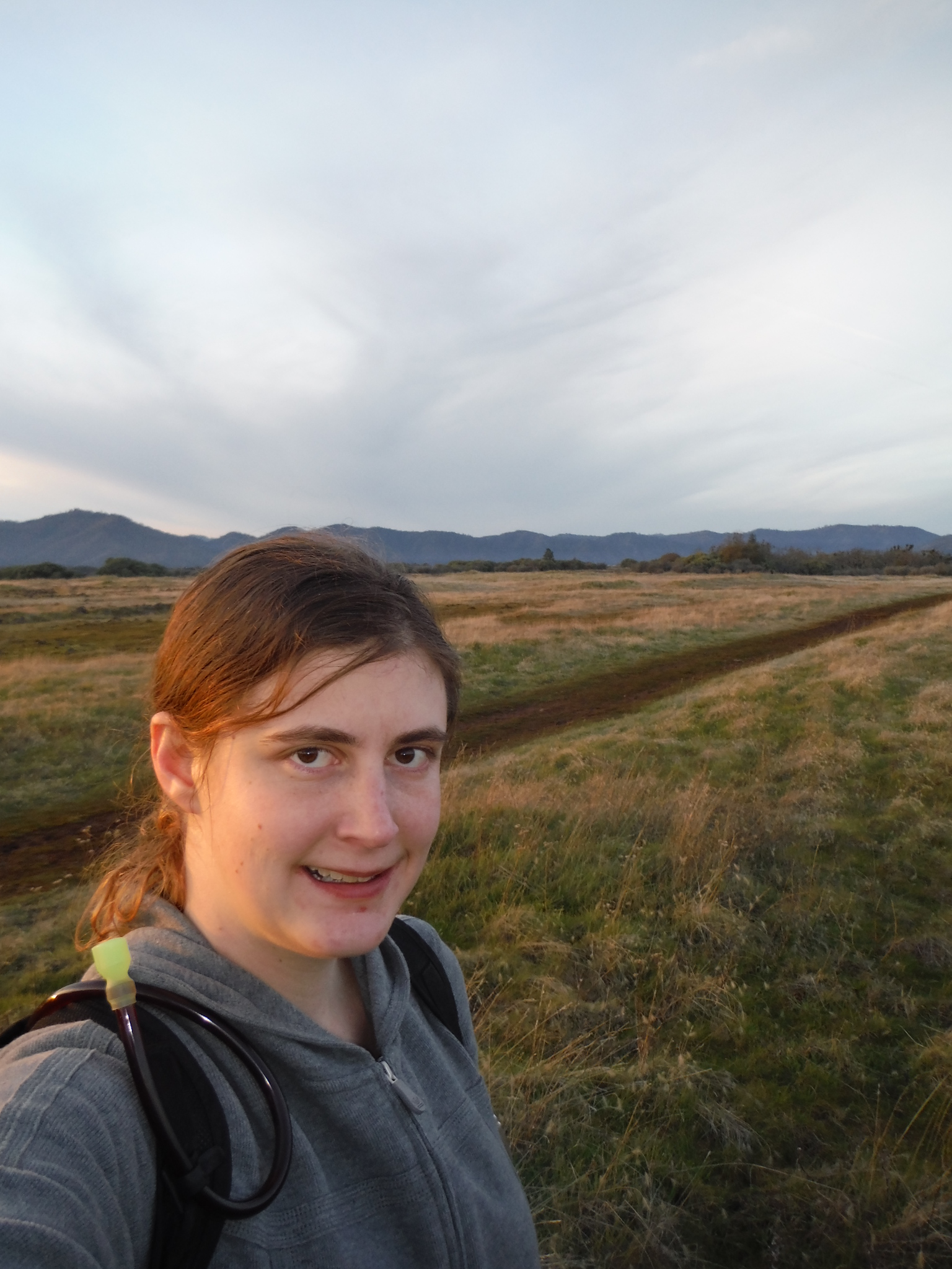
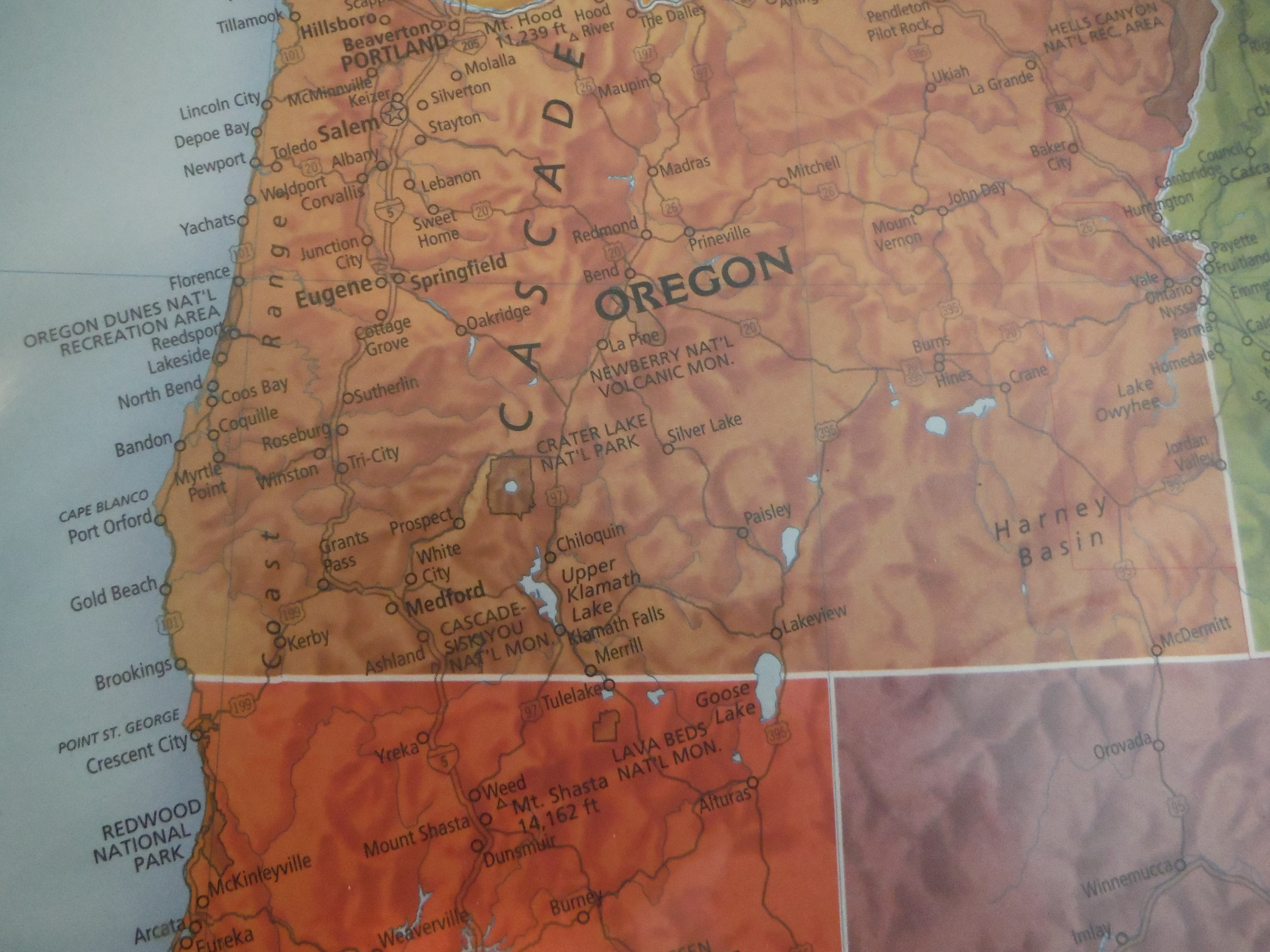
For several weeks, my friends and I have planned to go on a trip to Northern California this Saturday. We were supposed to go to the Redwoods, but people and plans changed, so my friend Steph and I made a last-minute switch and headed to Lava Beds National Monument instead, which is east of the Redwoods in Northern California. Although both of us had been here many years ago, with the length of time since our last visits and flying by the seat of our pants, we weren’t sure what to expect. Yet we left incredibly impressed with all that there was to do!

DSCF5016

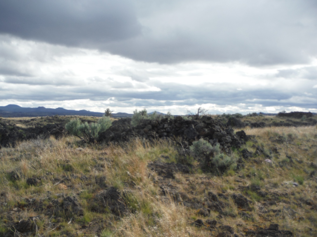
  • We admired all the volcanic rock we passed on the way in the monument.
  • We watched an informational video at the Visitors’ Center about the history of the lava tube formation and American Indian tribes that were forced out of this area.
  • A park ranger taught us about the white-nose fungus that is killing bats and quizzed us on our past caving experience to see if any of our clothes needed to be decontaminated. Once we passed, she gave us a caving permit.
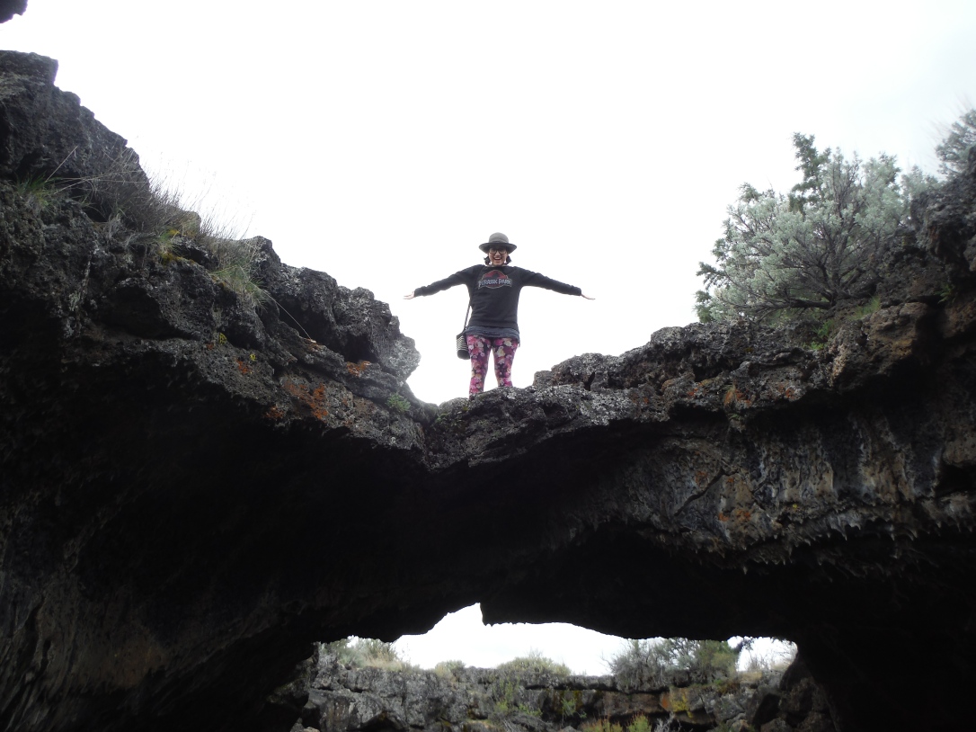
  • We drove around the Cave Loop and stopped at any caves that were open. (Some were closed to protect the bats living inside.)
  • Since caves are 55 degrees year-round, I was glad I had left a coat in my backseat! We ended up getting warm from all the exercise we did, anyway.
  • Although the Visitors’ Center loans out free flashlights since battery-powered lights are required to enter the cave, we decided to use our cell phone flashlights just so we’d have one less thing to lug around. I learned that my phone flashlight turns on and off by shaking it. Typically I might think that was convenient, but it wasn’t so helpful when I stumbled around caves!
  • One of my favorite cave names was called “Hopkins Chocolate”, which is named because some of the lava coating inside looks like dark chocolate is dripping down the cave walls!
  • There were other neat-looking things in other caves. Some of the caves had what looked like moss growing on it. (Not sure if it was something living or just the way the rock was colored.) When scattered among the dripping moisture creating stalactites, shining a flashlight on it makes the green specks look like fool’s gold, and the white looks like specks of silver!
  • The next time I go, I’ll probably want to bring a helmet, a headlamp, and maybe gloves so I can go further into some of the lava tubes. Since we weren’t equipped, we decided not to go anywhere that required crawling, but there were quite a few areas that involved ducking down!
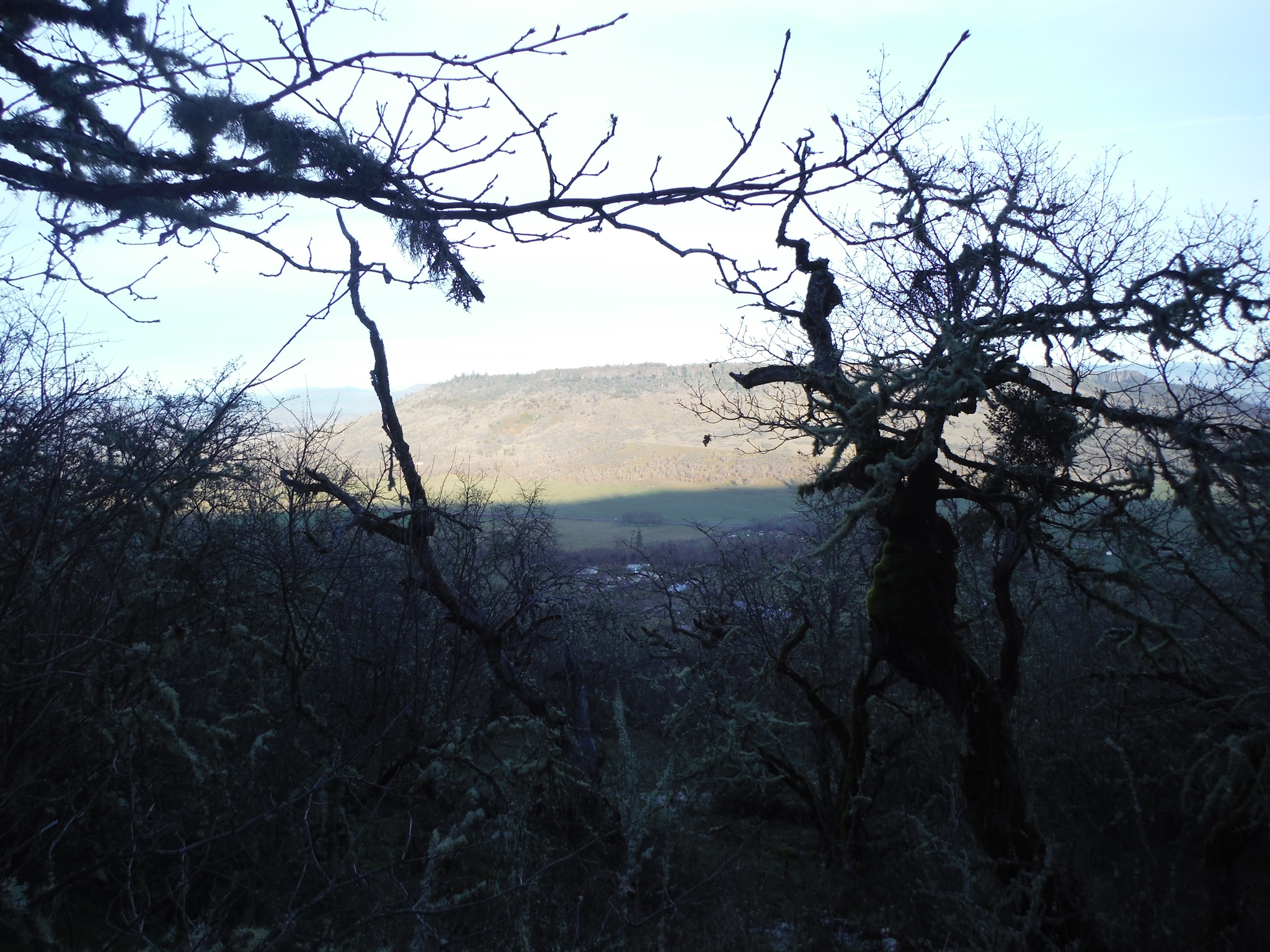
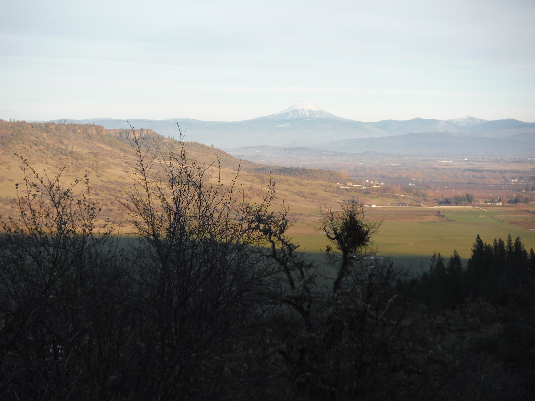
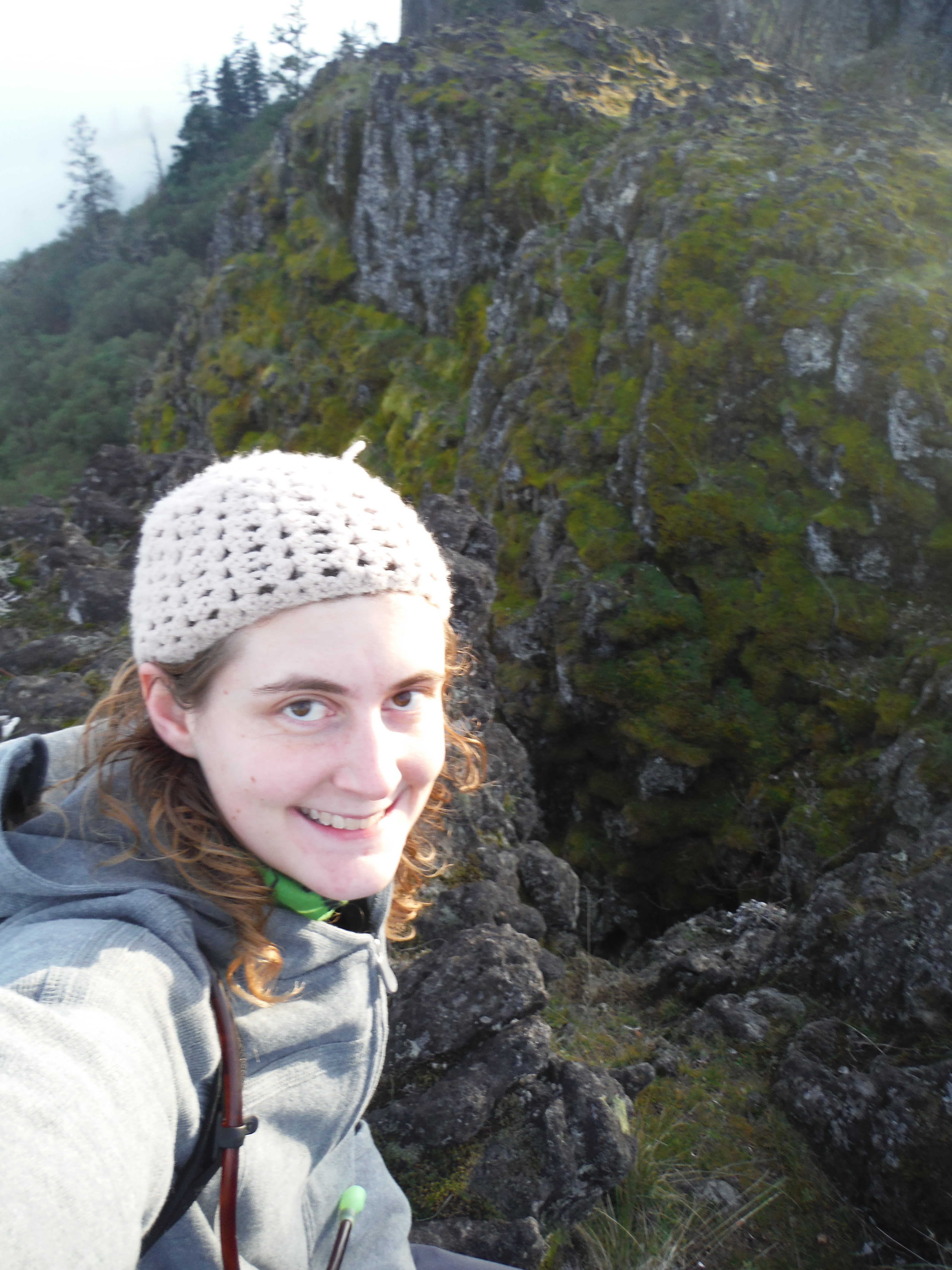
  • There were some nice places to walk, too! Both Steph and I really wanted to hike up Schonchin Butte, a .7-mile uphill trail that leads to a fire lookout. The lookout itself is closed for the season until tomorrow, but we got some great views!
  • Although there was so much more we could have done, we decided that the last activity for the day would be to walk around Captain Jack’s Stronghold. This was an area where the military fought against the natives to force them out of this area. Although the history is sad, it was neat to see some of the rock structures that they built that are still standing today.DSCF5028

Sunday: Crater Lake National ParkDSCF5042

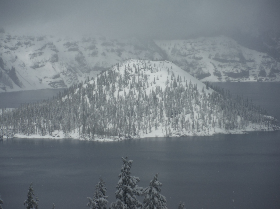
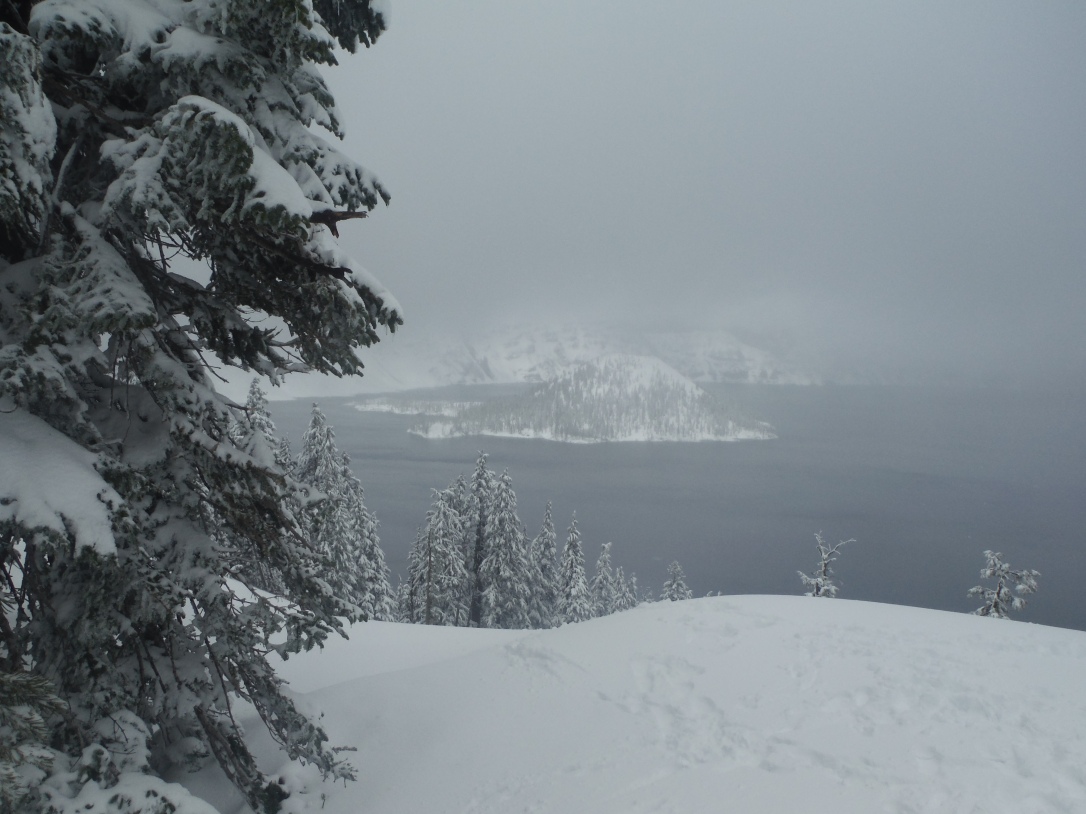
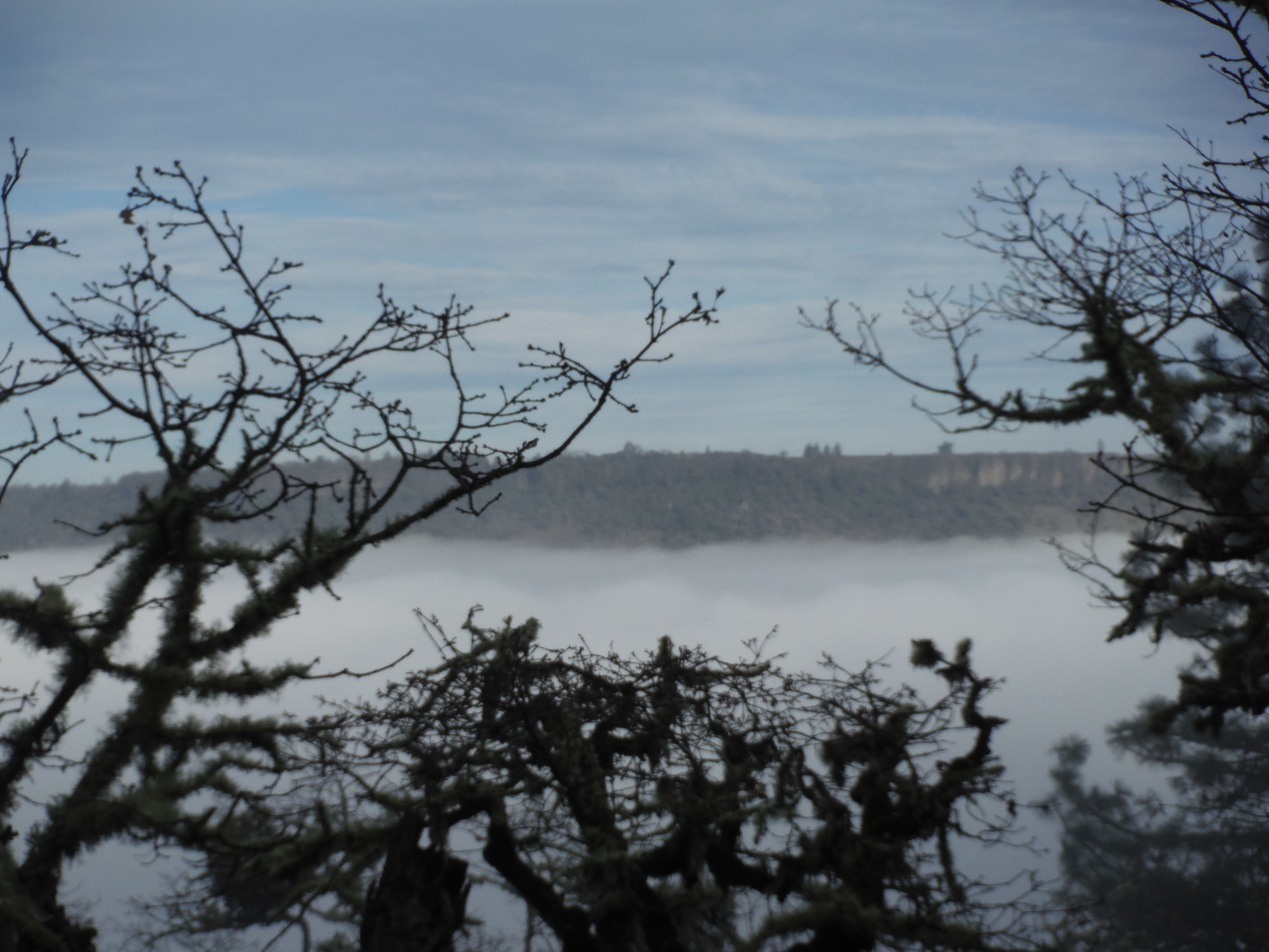
I had so much fun on Saturday, I decided to continue the National Park and volcano-themed weekend my closest National Park, Crater Lake. Since this wasn’t as long of a drive, I decided I could make it to church (although I did attend the 9 am service instead the 10:45 service I normally go to), and then head out. With only slightly more planning today than yesterday, I ended up going alone this time. I went to Crater Lake almost exactly a year ago, and it was so odd to see how different it looked this year!DSCF5031

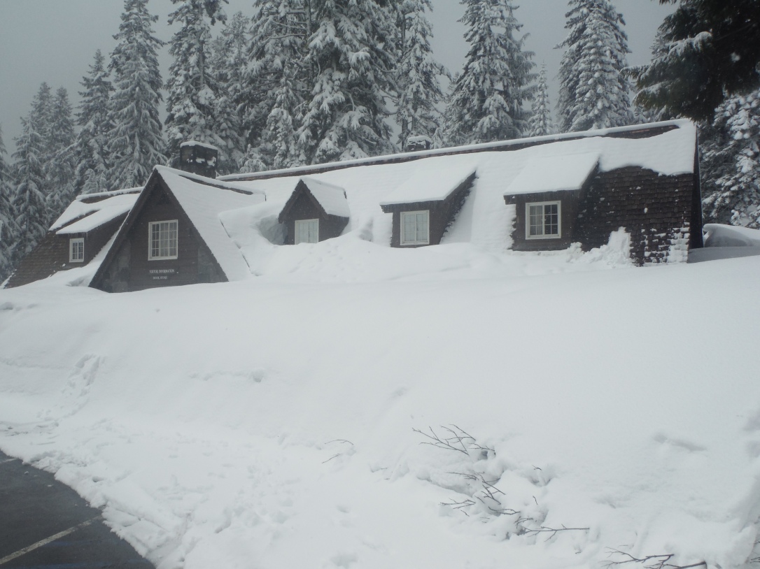
  • It was already a rainy day, and I was praying that it wouldn’t rain while I was at the park. That prayer was answered, but not in the way I expected! As I crossed the park boundary line, I noticed that all the trees were covered in snow. In fact, it was actively snowing most of the time I was there! It’s late April!
  • My first stop was the Visitors’ Center, where I watched the video about the surrounding nature and how Crater Lake was formed by a giant volcano eruption followed by years of collected rain and snowfall. I had to enter and exit the Visitors’ Center from the side entrance because the front entrance was covered with snow all the way up to the roof!
  • I then drove up to Rim Village (being careful in the Avalanche Zone), and parked next to the lodge.
  • After browsing the gift shop in the lodge, I went up to the top floor, which is supposed to have an observation window. Maybe it works on clearer days, but with all the snow and clouds, it was impossible to see the lake from here! Instead I read the museum-style informational signs.
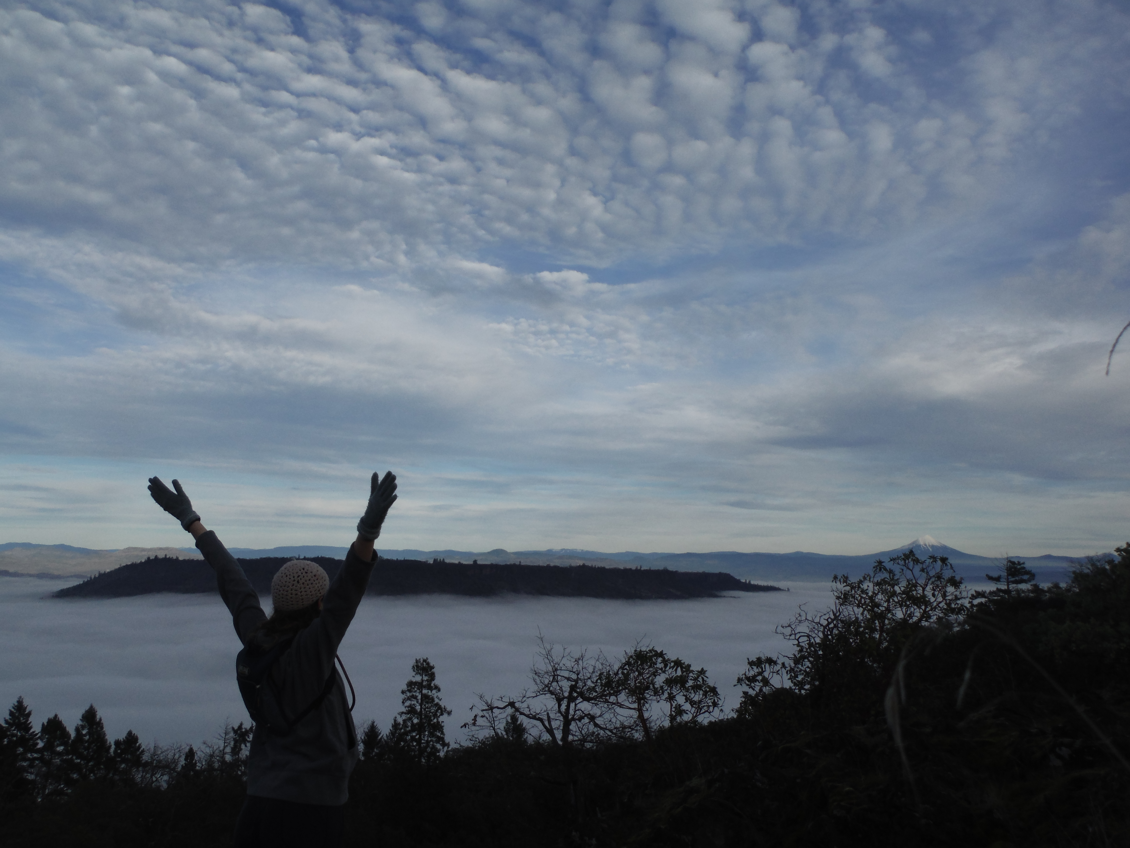
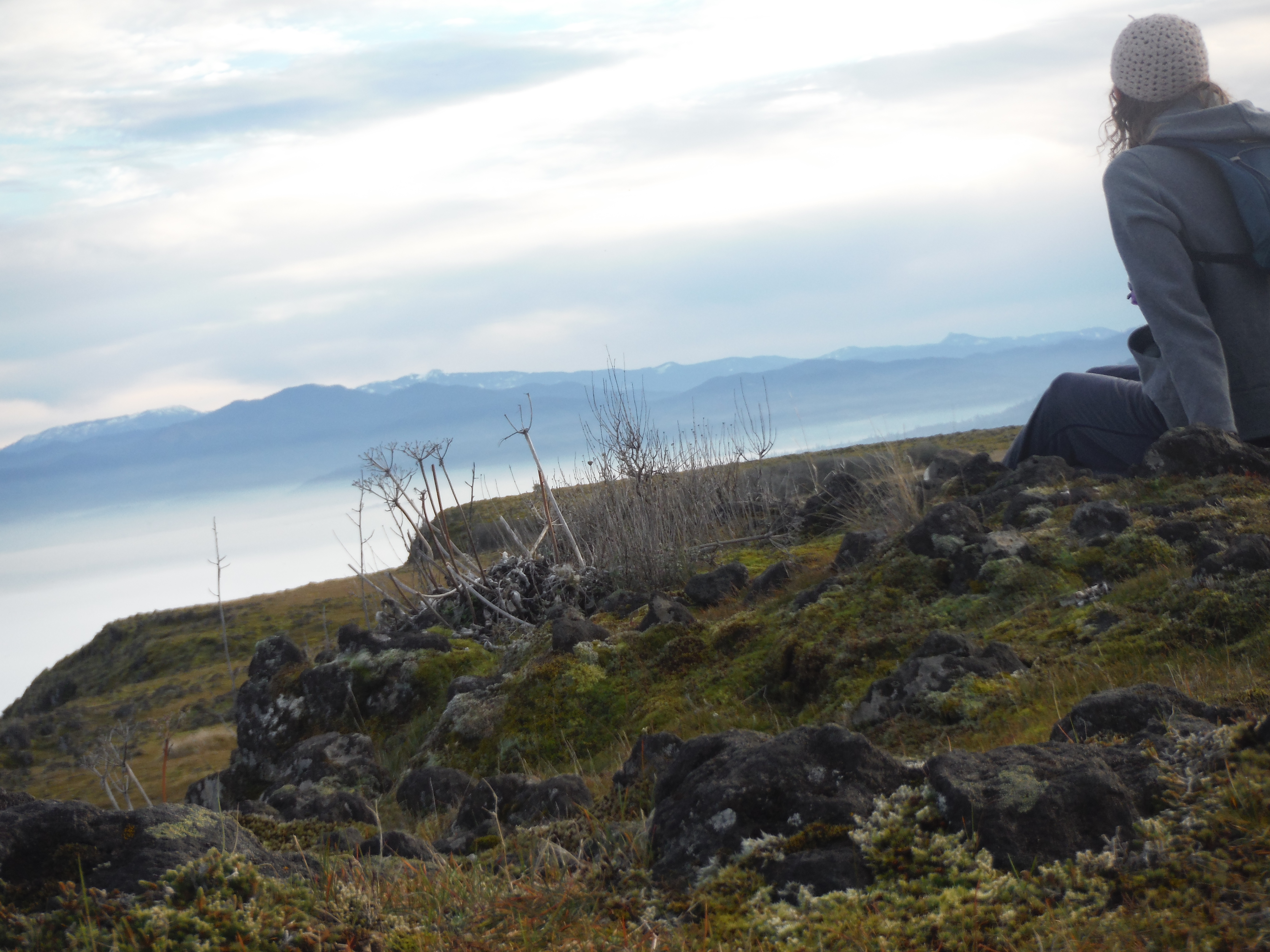
  • I decided that the only way I would have a chance at seeing the lake was to walk through the snow myself. Fortunately, I still had my coat in the back of the car, although I definitely would have benefited from more winter gear!
  • I followed the others who were also outside to the farthest point that could be reached without crossing the safety line. As I looked out, I could barely see Wizard Island, the large island in Crater Lake. After a few minutes in the cold, the air cleared up for some precious seconds where we got to take pictures. It still didn’t display the bluer-than-blue color I’ve seen on sunnier days, though!
  • I warmed up in the lodge for awhile longer, when a park ranger told me to look out the window. You could barely make out part of the back rim, but he said that was the clearest it had been all weekend. Yesterday they basically couldn’t see the lake at all!
  • I went out to the safety line for one more photo shoot, but then decided to turn back and head home. In the summer you can usually drive around the whole lake, but since it snows year-round at Crater Lake National Park, they limit their snowplowing in the winter to only the roads to the South Entrance, Visitors’ Center, and Rim Village.
  • On the way back, I stopped for a short walk by Union Creek. My family used to go camping there when I was a kid. I walked by the Rogue River Gorge and saw the Living Stump!
  • My family had a dinner all together tonight, and since I knew my sister had gone to Crater Lake National Park last weekend, I asked her how well she could see the lake that day. She looked at me confused as she told me it was a perfectly clear day and that many of the visitors were wearing shorts! It’s funny how much the weather can change from one week to the next!DSCF5036

Where to Next?

Hmm…good question! I had been admiring the National Parks Passport for some time now, and finally decided to purchase one at Lava Beds National Monument. This is an informational book about all the National Parks in the United States. Every time you visit a National Park, Monument, or Historic Site, you can get a page of the passport stamped. Since I knocked out two parks in just this weekend, I already have two stamps! Now it will be used as encouragement to visit more National Parks.

The Oregon Caves National Monument is fairly close to me, so I may go there sometime soon. Of course, we need to reschedule our trip to the Redwoods that we had originally planned for Saturday! Although we were going for the Trees of Mystery and the Tour-Thru Tree, I can stop by a Redwoods National Park center for a passport stamp.

Although I would love to become a National Parks junkie, it was really only financially possible for me to visit two National Parks in just one weekend because it was part of National Park Week, and the National Park Service allowed all parks and monuments to have free entrance. Normally Lava Beds and Crater Lake each have a $15 entrance fee per car. I would definitely love to take advantage of the upcoming entrance days in August, September, November, or any of the other free days listed here. To save money on National Parks in the future, I may consider getting an annual pass (I can’t wait until I’m 62 and can get the discounted lifetime pass!), or I may try to find out which of my friends have a fourth-grade child, since a car with a fourth grader in it can enter National Parks for free! Some National Parks and Monuments are always free, which thankfully, the Oregon Caves and Redwoods both fall into the free category!

day trip, destinations, geography, hike, road trip, saving money, souvenir, travel tips

Glass Float Treasure Hunt

This past weekend, I was finally able to get some real use out of my new car! Sure, I’ve taken it to work and to run errands, but it’s about time that it got to go somewhere fun out of town. And for about sixteen dollars in gas (which was the only expense of this trip), my friend and I were able to spend a fun and adventurous day looking for glass floats in Gold Beach, Oregon.

12795063_10154039312433783_2294133375615448373_o (1)

Last year, I saw a TV ad from Gold Beach tourism. They announced that every week between February and April, they hide over 100 glass floats along their coast for visitors to find. If you find one, you get to keep it AND enter a drawing for a free weekend trip! I wasn’t able to make it out to Gold Beach last year. However, after deciding to buy my car this month, I began coordinating schedules with friends to find a time to head out to the coast. Steph and I both had time off this past weekend! (She was even the photographer of all these images because I forgot my camera and my cell phone was acting up over the weekend.) We headed out on Saturday morning.

My car’s maiden voyage was a success. I learned a few new things about it, like where to pop the gas door, how to play music through the stereo with an auxiliary cable,  and how to spray wiper fluid on the front windshield. The drive to the coast is beautiful. There actually isn’t a direct route west to the coast. Directions to Gold Beach led us into California and through the Redwood Forest before heading back up along the coast, which always makes for a beautiful ride. Along the way, we saw lots of interesting things that we made note of to stop by on the way back.

It was past lunchtime by the time we made it to the coast. We considered the restaurant options, but decided to just eat what we had packed. We parked at the Gold Beach Visitor’s Center, which has a picnic area, bathrooms, and an information building. Inside that building, we were given a map outlining the perimeters for where the floats were placed. After eating, we started traipsing through the tall grass. We figured it was most likely in this area, because the tide covered most of the sand, and floats are not hidden anywhere that would cause them to be swept into the ocean. We looked under driftwood, in holes, and between rocks, to no avail. We saw other people searching, but no one who actually had found a float. After this hunting method resulted in only finding garbage, we decided to walk down to the jetty, which was a boundary on the map. We hoped that the further away we got from the Visitor’s Center, the more likely we would be to find something.

On the walk there, I had to mentally prepare myself for disappointment. I knew the chances of us finding a float were slim, so I considered the alternatives. If we gave up, we could go shopping at some of the stores in town. If we spent at least $25 at certain stores, we just had to bring the receipts in to the Visitor’s Center and get a glass float from there. But that didn’t sound like as much fun as finding one on the beach for free. Fortunately, a glimmer of red caught my eye. It was a glass float!

12440800_10154039311713783_2881019246664324017_o (1)

Not only did I find a glass float, but we ended up finding several all within a few minutes! The treasure hunt rules ask participants to only take one per person, so we left a few of them for others to find. Steph ended up with a small teal globe. I picked my favorite, a larger blue one. We slowly headed back to the Visitor’s Center (stopping to admire the beach and shoot photos on the lighthouse). The staff at the center told us that they were impressed that we were able to find even one that day as we filled out our contest entry forms.

It hadn’t seem like we walked that far (until the next day when my legs were sore), and it also didn’t seem like we had been beach combing for that long. But we had walked several miles, and were out for about three hours! I didn’t realize this until we hopped back into the car and saw the clock saying it was 4:30. But we still had enough daylight to see the things we wanted to see on the way back.

12747932_10154039316733783_2741029845922871646_o

We didn’t stop in the nearby coastal town of Brookings, but as we drove through it, we got a good look at the sinkhole that’s slowly taking over the highway. That was pretty scary! We also drove over Oregon’s highest bridge and saw a huge herd of wild elk. Our first actual stop was near the redwoods, on a nature trail with carnivorous plants called Darlingtonia (pictured in the marsh above).

12764757_10154039320383783_5044618060661753712_o

The second stop was just a couple of miles down the road at a waterfall. I would tell you what this waterfall was named, or really any information about this waterfall, but I can’t. There were no signs or plaques, so it’ll just be called “The Waterfall We Saw On the Way to Gold Beach”.

12792175_10154039330458783_3683189505727718052_o

There were several other places worth seeing through the comfort of the car window. If you’re visiting from further away, some of them may be worth stopping at, but we’ve grown up with the sights of the giant redwoods and the mountain roads that twist, turn, and tunnel.

12029760_10154039339843783_3718692029023249501_o

While I’m not sure if we’ll be so fortunate in each finding a glass float in the future, I do hope to do this again and encourage you to try it out, too! Click here for more information on Gold Beach’s annual three-month treasure hunt!

geography

Local News When You’re a World Away

A few weeks ago, I excitedly met another Oregonian at Ciak Hostel in Rome. A favorite past time of ours was going to Fassi, a gelato shop just a couple blocks away. This was the original gelateria, but we found out that they have a Korean franchise. We joked that we should start a franchise in Oregon, but since she was in Eugene and I was in Medford, we would have to find a midway point. “So Roseburg, I guess?” I figured a franchise there wouldn’t do too well, since nothing really happens in Roseburg.

Now I wish nothing happened in Roseburg.

I got the news ping shortly after the news broke, and continued getting updates on my phone as more information on the victims was released. I know several people going to Umpqua Community College, and thankfully they all ended up being in the right place at the right time, away from the gunfire. But of course it still made my heart hurt that lives were lost, and that it was so close to home. Does it make a difference that I’m currently in Eastern Europe?

In trip preparations, I had thought about what I might do if tragedy struck in a city I was visiting. But I didn’t have a plan for if something like this happened back at home.  So what can I do? At first, it may seem like nothing, but in cases like this, here’s what you can do, no matter where in the world you are:

Keep Updated with the News. My Yahoo app has been a wonderful resource in keeping me in the loop throughout this trip. Despite not being in America for nearly three months now, people from other countries often ask me for inside information on American news. At least I know what’s going on.

Keep Updated with Those Close I’m pretty sure anyone who has had a close call with a disaster makes contact as soon as possible to let others know they’re okay. My Roseburg friends posted on Facebook immediately. I also waited for the list of victim names to be posted in case a former classmate or other long lost peer was involved.

Pray Sometimes seems like all you can do. But since prayer gives you focus, clarity, and meaning, it’s often the best thing you can do! Sometimes I equate prayer with worry, which is definitely not supposed to be. Truly praying for a situation means acknowledging its existence, and knowing that, unless you are called upon for a specific task, it is no longer in your hands.

Be Realistic Would I have made a difference if I were at home? Probably not. Sure, I could’ve visited shaken-up friends. But instead they know that people are thinking of them even on the other side of the world. And I could’ve responded as an EMT. Okay, if I actually worked on an EMT squad, and my jurisdiction included Roseburg, then there could be a tiny chance that I would be called to help the victims. But when I thought about that, I would still much rather spend three months backpacking Europe, and I can help others no matter where I am. (And this shooting has been a factor in persuading me to start using my EMT credentials again. I’m not sure yet, but I’m a step closer!)

Be Thankful for Life Remember after 9/11 when so many were terrified to fly? Every accident or tragedy seems to convince more people that the way to live life is to stay at home, locked away from the dangerous world. I really think that this is missing the point. Even if this lifestyle was physically healthy (which it isn’t), it is terrible for mental health. I think getting out there and being adventurous is the best way to overcome. It shows that we are not afraid and that the threat did not win. I think it would be really cool if a group of students had an adventure in honor of this event, to prove that the victims did not die in vain. Don’t live in fear!

I apologize if this post wasn’t up to par with my travel posts or if some of my advice sounded off. This wasn’t really meant to be an advice post, but more of a reminder for me as I still try to process everything that happened. In times like these, I guess it doesn’t really matter if it happened next door or a world away.

Update October 6th, 2015: Yesterday, Rogue CC, one of the colleges I attended, experienced a major bomb threat. As the bad news keeps coming, we need more brave and positive people to bring hope!

Update October 7th, 2015: There is news of yet another bomb threat at another college I attended. So in the past week alone, Southern Oregon colleges have experienced a mass shooting and at least two bomb threats. And the people there were concerned about the places I was going! Safety is not a guaranteed in any situation, so you can use this life fact to your advantage and take adventurous risks, or live in fear and a class sense of security. The choice is yours.

backpack, geography, saving money

Where in the EU am I Backpacking?

It’s been awhile since I’ve posted specifically about my upcoming European backpacking trip, even though that’s what I spend most of my waking time thinking about! So I thought I’d share a quick update with you.

As a US citizen, I can spend a total of 90 days in most of the European countries. There are a few nations that do not follow this rule, but after three months it would probably be best for me to return to North America anyway. Ever since I started planning this trip, it seemed overwhelming. How would I split up 90 days over about 20 countries without feeling rushed through each city? Plus, transportation fees were also an issue. Eurail is probably the least expensive way to effectively travel throughout Europe, but an unlimited all-nation pass isn’t exactly cheap!

I finally came to a realization that would save me money, travel time, and ultimately, make me a happy traveler who could do more of what I wanted to do:

I would go on a Mediterranean Backpacking Adventure!

Mediterranean_Relief
Image source: http://en.wikipedia.org/wiki/Mediterranean_Sea

The plans aren’t set in stone yet, but starting in either France or Spain, I would travel along the European countries lining the Mediterranean, spending one to two weeks in each city I’m interested in visiting, until I reach the Asian border in Istanbul, Turkey. Switzerland is a landlocked country, but I’d probably go there as well because I like cheese and chocolate. But it wouldn’t be just backpacking. I will volunteer with an organization that teaches English to businesspeople in Spain, retrace the steps of the early church, use my marketing skills to allow small tourism businesses to prosper, visit missionaries, and hopefully find some sort of orphan or childcare organization to help with somewhere along the way!

In total, I am planning for visiting potentially nine countries (including the two smallest nations in the world) and two continents (possibly three if I can find a cheap way to get between Spain and Morocco) in a half of the world I have never seen, leaving in about five months! And I can use all the help I can get!

What advice do you have for me regarding this trip, either for before or during this journey?

day trip, geography, hike

Up There on Lower Table Rock

001

The Table Rocks are a sight to see in Southern Oregon. These plateaus are not only a unique view in the mountain range, but the hiking trails on each of these twin mountains leads hikers to a unique view of Jackson County at the top.

002

I’m actually ashamed to say that, although I always lived within a half mile drive of these mountains for most of my childhood, I only hiked them a handful of times. I believe the first time was when I was in fourth grade and we took a class trip there. Even our first-grade buddies were able to keep up on the strenuous hike! I remember hiking with my family once during the winter rain, and my shoes got stuck in a sticky mud puddle, causing me to face plant in a pile of mud! There was also one time I went with my youth group. In our middle school rebellious state, my friend and I carved our initials on a tree and watched as some of the boys threw things off the edge of the mountain, including a paper airplane and an orange. The last time I hiked up Table Rock was when I was still in high school, with a few of my closest friends at the time. Being able to count my Table Rock memories on one hand, I knew I needed to return.

004

Last weekend, I had Saturday off. Between working at a call center and being a weekend nanny, this is an incredibly rare occurrence, so I had to celebrate it in some way. I invited a couple of friends to do something with me, suggesting Table Rock as an option. Unfortunately, while I had a rare Saturday off, they did not. Not to worry though; I’ve traversed the continent by myself, I should be able to manage a little hike a few miles outside of town!

On Saturday morning, before I even changed out of my pajamas, I received a phone call. I was off from jobs #1 and #2, but job #3 called. The housemother on duty at the teen mother home wasn’t feeling well, so I was asked to cover for her. I love spending time there, so it was not a problem to change my plans. Besides, I would get off at 3:00, so I would still have time to go for a hike afterward.

006

There are two mountains that make up the collective Table Rocks: Upper Table Rock and Lower Table Rock. They’re not named for their heights; they’re named for their location on the river. Upper Table Rock is faster to get to, but it’s in a location with more shade, so I was afraid that, with Oregon’s liquid winters, that would translate to more mud. (I’m pretty sure that was the one we hiked when I fell in the mud!) So I decided to go out to the more iconic Lower Table Rock.

Thinking back to my first hike, we must have taken a lot of breathers and extended stops where our guides explained the flora and history of Table Rock. The incline really does get your heart pumping! It’s less than two miles to reach the summit of about 800 feet, and I was so relieved to get to the top.

008

My goal behind reaching the top (besides the mini-challenge in itself to reach the top) was to get a bird’s eye view of the county. The trail takes you to the side of the plateau opposite of the metropolitan area, so I began walking to the other side to see what I could see.

009

What I saw was a sunset. While pretty, it meant that I would need to turn around soon in order to make it back to my car by the time it got dark. So after spending several minutes at the summit, I turned around and headed back down, determined to try again in a few days.

011

My next day off was Thursday, so I headed back to Table Rock that day. The problem was, while I wouldn’t have gone if it was raining (you know, the whole mud thing), it was incredibly foggy.

002

So I waited until the afternoon in hopes that the fog would lift. It did clear up a little bit, and when I got to the top of Lower Table Rock, it was bright and sunny. Of course, that was just because all the fog was below me! Yes, a thick layer of fog separated me at the summit from the views below. Although, it did provide a unique view of the fog. It almost looked like an ocean!

008

Two hikes in one week, and I still didn’t get what I came for. But third time’s the charm, right? Perhaps next time, on a clear, dry day with plenty of time before dark, I will have a picture of an incredible view to show you!


019

014

day trip, destinations, geography, tour

The Vexing Oregon Vortex

Have you ever been to a House of Mystery before? The slanted floor, uneven roof, and caving walls allow for lots of optical illusions and a playground for your mind. But what if some of these illusions continued even after you left the mystery house? You may discover that this is exactly what happens at the Oregon Vortex!

The drive to the Oregon Vortex provided beautiful fall scenery through the quaint town of Gold Hill and the rural area beyond. Even though it is remote, there are plenty of billboard-sized signs pointing in the right direction. We arrived at a historic mining shantytown where friendly staff were happy to greet us. Several of the staff members donned crazy costumes, but I’m pretty sure that was just because it was Halloween.

Because we arrived several minutes before our tour could begin, one staff member mesmerized everyone in the gift shop with the scientific magic of magnetism. He also demonstrated how non-magnetic metals can still react to magnets, and even how magnetism can slow the force of gravity! This was a great primer before we were introduced to the Oregon Vortex, which is believed to be a strong disruption in the Earth’s typical magnetic field.

IMG_20141031_150326_287[1]

I decided to visit the Vortex a bit spur-of-the-moment. And since I went early afternoon on a weekday (and I guess October 31st is technically a holiday to some people), I had a hard time finding someone who was able to accompany me last-minute. Fortunately, my mom had a free afternoon, so I got to spend time with her on this tour! She was actually the first person in our tour group to demonstrate one of the odd features of the Vortex. In the center of the above picture is a brick line. Our tour guide on the left is inside the Vortex, and across the line, my mom is outside of it. It was strange to see their differences when they switched places, and it even felt a little different for them! I noticed that I got a bit of a “seasick” feeling when we started the tour, but after we left, it disappeared. Our guide said that happened to some people due to the polarization. We also noticed that there weren’t any animals around- no squirrels, no birds, nothing. That was strange since we were in the middle of a forest, but for some unexplained reason, many animal species avoid the Vortex.

IMG_20141031_151309_766[1]

My mom wasn’t the only person in our group that demonstrated an anomaly. The guide made sure to include everyone in our group, even the young children. Since I was the tallest, I was picked on a lot. In the above picture, the guide and I stood a few feet away from each other and placed a beam on top of our heads. Everyone else noticed it was slanted since I was several inches taller. But when we switched places, the beam was almost level! IMG_20141031_152011_895[1]

After several experiments near the outskirts of the Oregon Vortex, we ventured further in where the House of Mystery was located. I’ve heard that houses like these are built to be used at fairs, amusement parks, and tourist traps. But this is the house that is said to have inspired all the other mystery houses, plus it has a 110-year history to boot. This was built to be an office and tool shed in the old mining town, but after it was abandoned it eventually slid off its foundation. No, it isn’t covered in cobwebs as suggested in the picture above. The staff just decided to decorate everything to celebrate Halloween, which is also their closing day. I did like their little ode to The Wizard of Oz:

IMG_20141031_152003_069[1]

The demonstrations done inside the House of Mystery were even crazier than the ones done outside. Not only did the Vortex affect things, but now all the weird slants of the house confused us too. We all appeared to be standing sideways, even though we were trying to stand straight. There was even a broom that, when stood on end, would stay balanced! It looked like it was leaning into thin air, but it was actually standing straight up and down!

IMG_20141031_153009_843[1]

The hovering broom was crazy enough, but it was even more insane when we saw a bottle seemingly roll uphill (because what looked like uphill was actually downhill). An ordinary golf ball was thrown down a slide out the window, but it also appeared to roll uphill as it returned to us!

IMG_20141031_153230_564[1]

Is it possible that the golf ball was magnetized, or that the broom was fashioned specifically so it would stand up? I’m sure that’s what many people reading this are thinking, and there is that possibility. But after visiting here, I doubt it. The staff told us that, if we returned, we were welcome to bring our own levels, measuring tape, and any other objects we wanted from home. I may have to try that in the future, but all their tools looked exactly like what you would get in any hardware store. I even felt and shook the golf ball, and even tested it for magnetism before we rolled it out the window. I don’t believe it’s all a hoax, even though I can’t explain it all. There have even been scientists perplexed at what happens in the Oregon Vortex. I guess that truly makes it a mystery!

IMG_20141031_154136_446[1]

After a few more demonstrations inside the House of Mystery, we exited from the uphill side to continue our tour. After the guide showed us some things, he gave us the opportunity, he gave us the opportunity to try some things out on our own, and even offered to take pictures!

IMG_20141031_155038_203[1]

I am five inches taller than my mom. We stood on a level surface (we even checked it with a level several times) with a beam on our heads. At first we looked like the picture above. I was quite a bit taller than my mom, which is typically normal. But then we switched places and took the next picture…

IMG_20141031_155049_705[1]

We were almost at exact eye level to each other! The change in the beam’s slant is a great indicator that this happened, but if you still don’t believe it, go ahead and measure us in each of the pictures. No one knows exactly what happens in the Oregon Vortex, but one theory is that our atoms are more compressed in certain areas.

IMG_20141031_155545_378[1]

We went to one final area near the farther end of the Vortex for the last few demonstrations. On this level piece of wood, we could see the participants get shorter and taller as the walked one way and the other! We could even see size comparisons as two people on each end walked towards each other!

When the outdoor tour ended, our guide encouraged us to come down to the gift shop where he would show us pictures of significant changes that happened to people while in the Oregon Vortex. There were even some pictures where magnetic lines showed up in the film as a result of the strong magnetic force. As we walked to the gift shop, our guide turned to us and asked, “Does it feel like you’re walking downhill?”

After all the questions he had asked us, like “Does this look level?” “Does this look larger?” “Do you feel different?”, which he then disproved, we thought we might be in for one last anomaly. But we were outside, with normal reference points. It really did feel like we were walking downhill! “That’s because you are” he said with a smile. Yes, there might not be much education behind the Oregon Vortex (other than teaching us to keep an open mind to new paradigms), but the hilarious staff is guaranteed to entertain you!

Would you like to visit the Oregon Vortex? You can’t. Well, at least not right now. They close for the winter in November. But not to fear, you can line up at their door beginning in March, and experience the historical, entertaining, and most of all, mysterious Oregon Vortex!

Thank you Oregon Vortex, for providing admission for my mom and me! We truly loved your attraction, and our opinions were not swayed by anything other than the great service you provide for every guest! 

geography, travel tips

The Map on the Kitchen Table

Although I was born in Oregon, I don’t consider myself an official Oregonian until age three. My family moved to California when I was just a few months old, but they later decided that Southern Oregon was truly home and moved back a couple years later. After renting for a short time, we moved into a lovely suburban home that not only had a dining room for our dining room table, but there was a space inside the kitchen for a table as well. I remember going to furniture stores with my parents, until they finally brought a bench seat corner table set into our home. But with my preschooler tendencies, plus the anticipation of another child, my mom was well aware that this table was just one accident away from spilled juice or coloring off the paper. To protect the wood, she decided to cover the table in plastic, but knowing that would look tacky, she made a creative decision that would not only protect the table, but would provide a lifetime of curiosity and learning.

map 001

My mom found a U.S. map about the same size as the table, and laid that out before wrapping the table with a thick plastic sheet. Even though my sister (who wasn’t even born when we got this table) and I are adults now, we know that this protective plastic coating is never coming off- it gives the table its character! Sure, we had to replace the aging map once, and my family has moved, but this kitchen table was sure to find its way in my parents’ current home. Whenever a few of us are gathered around this, it always turns into either a geography lesson or a story about someone’s American Adventure.

map 003

Guests always loved looking at our table. Of course, the first place everyone has to locate is where they call home- which, for many of our guests, has been good old Southern Oregon. People love pointing out their birth town, places they have lived, interesting places they’ve visited, and where their family is from.

map 004

I’ve always appreciated the detail of such a large map as it makes it easy to figure out where exactly my friends and relatives live. Many of my relatives live in Southern California, and I’ve been able to locate every single city they live in! When planning family visits, we often used our finger to trace our route down the I-5. When my parents, sister, and I travel separate from each other, we often gather around this table afterwards and trace out everywhere we went. It’s not quite like joining them on the trip, but it gives the rest of us a more realistic perspective of what the trip was actually like! While living in the Midwest, I would come back for Christmas break and enjoy pointing out the trips I took, especially my long solo road trip between Nebraska and Ohio.

map 005

Nowadays, one of my favorite routes I like to trace on this map is the bus trip I took across the country. I remember while on that trip, probably somewhere in Wyoming, another bus passenger stated that she wished she and her family knew American geography better. I immediately thought of this and told her all about how my family sealed a map on the kitchen table when I was growing up. She was interested in the idea, as many of our guests have been, and I recalled all the fun memories that took place seated at this table. Who would have guessed that, of all things, I would be looking forward to once again seeing the map on the kitchen table?